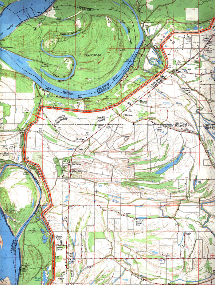


DISTRICT MAP #8
DISTRICT MAPS
MAPS OF LEVEE BOUNDARIES
The Geospatial Interactive Technologies department at Delta State University has created a Flash-based interactive map of all the levee districts. Click here to open the map.
The pictures below are excerpts of quadrangle maps showing the Yazoo-Mississippi Delta Levee outlined in red. Map #1 begins at Levee Mile Station near the Tennessee state line, and Map #8 reflects the boundary between the Yazoo-Mississippi Delta Levee District at Levee Mile Station 98 near the Coahoma/Bolivar County Line. Click on the pictures below to open an enlarged version of each map.
District Map #8