

DISTRICT INFORMATION
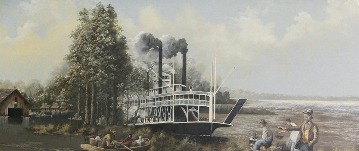
ABOUT THE LEVEE
DISTRICT INFORMATION
The mission of the Board of Levee Commissioners for the Yazoo-Mississippi Delta is to erect and maintain a system of levees to protect the people and property of the Delta from damages from high waters of the Mississippi River. It also directs the necessary activities to protect lives and property from the threat of flooding from interior streams, and furnishes the local cooperation for various flood control projects of the U.S. Army Corps of Engineers.
Today, the District is responsible for 98 miles of mainline Mississippi River levee starting just south of Memphis to the Bolivar County line, 18 miles of backwater protection levee on the Yazoo River in Yazoo/Warren Counties, and 320 miles of interior rivers and streams.
The Yazoo-Mississippi Delta is an alluvial flood plain formed by flooding of the Mississippi River over thousands of years. The first attempt to control this seasonal flooding was in 1819, just two years after Mississippi became a state, when the General Assembly adopted an act to erect a levee in Warren County.
Numerous efforts were made up to the time of the Civil War to protect a rapidly developing Delta from the ravages of the Mississippi River. During the war, work on the levees ceased, the flood of 1862 and subsequent floods did extensive damage, and sections were destroyed as military objectives. After the war, political and economic systems were in shambles, and flood control was one of many urgent needs. The lower part of the Delta had a greater need for flood protection, as floodwaters in the upper Delta would flow away through interior streams. The upper Delta counties chose to forgo the repair of the levee system, but people in Washington, Bolivar and Issaquena counties banded together in 1865 to restore the 1858 levee. Then, in 1877, the Mississippi Legislature passed an act to reorganize and enlarge this board into the Board of Mississippi Levee Commissioners.
While this Board made progress to rebuild the levee through Bolivar County, southward to Vicksburg, the upper counties remained relatively unprotected. It took three events to convince the upper Delta to close the Mississippi River levee.
The first event was the formation by Congress of the Mississippi River Commission in 1879. Flood control was not authorized as one of the commissioners' purposes, but levee construction could be approved where it would help maintain navigation. Local interests interpreted this change as growing recognition of Mississippi River flooding as a national problem.
The second was interest in the continued development of the Delta, which led to the construction of the Memphis and Vicksburg Railroad in 1882. The railroad and upper Delta landowners joined together to promote the formation of a new levee district.
And third, the flood of 1882 caused widespread damage through the upper Delta and proved that continued development would be impossible without control of Mississippi River flooding.
The Yazoo-Mississippi Delta Levee District was formed by an act of the State Legislature in 1884 and soon afterward joined with the Mississippi Levee District in closing and enlarging the levee system from Memphis to Vicksburg. Despite these efforts, the Yazoo-Mississippi Levee Board carried on a desperate fight on 40 miles of levee in 1897 and suffered a major break in the levee at Flower Lake. The flood of 1897 received national attention for a national program of flood control in the Mississippi Valley.
In 1917, Congress adopted the first true Flood Control Act to relieve Mississippi River overflow by setting standards for higher and stronger levees and placing revetments to prevent loss of levees to caving riverbanks. The act called for local cost sharing, and the local districts were charged with the responsibility of providing maintenance and right of way. But the Yazoo-Mississippi Delta Levee District's levees were already up to the newly enacted standards, and the district did not qualify for federal work under the act.
In 1927 the "flood of record" took place in the Mississippi Valley. President Herbert Hoover described this event as "the greatest peacetime disaster in the history of the United States." This flood brought about passage by Congress of The Flood Control Act of 1928, which recognized that Mississippi River flooding was of national concern and not just the concern of local or state authorities.
The success of this combined federal and local effort is the fact that the second highest flood on record in 1937 flowed safely through the Mississippi Valley without a single levee break. This flood did come dangerously close to the top of the levee in some places, and foundation and underseepage problems became very serious threats. Evaluation of this flood led to new standards incorporated into the Flood Control Act of 1941.
The Mississippi Valley and the Board of Levee Commissioners for the Yazoo-Mississippi Delta went from 1937 to 1972 without a flood event, which left a new generation with little or no personal knowledge of the devastation of Mississippi River floods.
The flood of 1973 proved once again that flood control must be given priority status for the protection of the Delta and the entire Mississippi Valley. Flood stages at St. Louis lasted 77 days and 89 days at Vicksburg. Although there was not a major levee failure in the Delta, the flood provided a continuous protracted fight to stabilize many weak points that developed.
The 1983 flood was significant by its duration with above-bank stages at many gauging stations almost continuously from December 1982 to June 1983. Emergencies occurred at numerous locations along the river. This flood again proved that constant attention must be paid to flood protection in order for the Delta and the entire Mississippi Valley to prosper.
Tremendous progress has been made since 1927 through the combined efforts of the U.S. Army Corps of Engineers and levee districts throughout the Mississippi Valley in flood control and river navigation. There is an unrealistic assumption that the dangers of Mississippi River overflows are events of the past. Mississippi River floods are weather related events that can and will occur throughout the Valley periodically.
Flooding from the Mississippi River is only one of two dangers facing the Delta. The second is from interior streams.
The Yazoo River Basin contains about 13,400 square miles of which half is in the Delta and half in the hills North and East of the Delta. The Delta portion of the basin is flat with a gradual slope to the South, averaging between only one quarter and one half-foot per mile. This causes floodwaters to accumulate and flow away slowly in the Delta over a long period of time. At the same time, water runs off rapidly from the hill portion of the basin carrying heavy loads of silt and sand to fill and restrict channel capacity of Delta streams.
To address this problem, Congress adopted the Flood Control Act of 1936, which provided a comprehensive plan called the Yazoo Headwater Project. The plan consisted of a combination of flood control reservoirs in the hill part of the basin and channel maintenance on the Yazoo River system to safely conduct floods through the Delta to the Mississippi.
The four hillside reservoirs of the Yazoo Headwater Project yield the quickest and best benefits. Work on Arkabutla, Sardis, Enid, and Grenada Reservoirs in 1936 was completed in 1955. The primary mission of the four reservoirs is flood control, and a secondary usage is recreation.
As construction of the reservoirs neared completion, work began on the levees and channels in the lower Delta to carry the modified water flows with the reservoirs operating. By 1962, the Whittington auxiliary channel, or lower channel, and the Greenwood protection works were completed.
The disastrous flood of 1973 clearly indicated the work that needed to be done to deal with the remaining flood threat. In 1974, the Corps of Engineers, after presenting a number of plans to the affected population, adopted a new plan, the Upper Yazoo Project. The UYP, which calls for enlarging the existing channel, was begun in 1976 near Yazoo City. This extremely important project is not complete.
Because the downstream channels are not yet able to handle the maximum levels of discharge from the hillside reservoirs, successive rain events have caused the reservoirs to overflow through their emergency spillways on a number of occasions creating downstream flooding problems.
These problems will disappear with the completion of the Upper Yazoo Project. Increased channel capacity, control levees, and other control structures will allow the four flood control reservoirs to operate as designed. A secondary benefit will be increased recreational use of the reservoirs due to elimination of some of the need for such large-scale water level reductions in the fall in the anticipation of winter rains.
Flood control is a very dynamic process, and for 200 years the people of the Delta have made steady progress toward making a better place for themselves and future generations. The personal and financial sacrifices made have paid enormous dividends. Relief from floods have made railroads and highways possible, providing access to markets, consolidation of school systems, and development of new industries. In addition, improved drainage has reduced sickness and improved agricultural production. The economic progress of the Delta is based on the principle that flood control and proper water management are basic keys to prosperity and quality of life in the Delta. The Board of Levee Commissioners for the Yazoo-Mississippi Delta is committed to this goal.